Rangabali Upazila is an administrative area under the Patuakhali District of Bangladesh. The location of Rangabali Upazila is at the foot of the Bay of Bengal.

It is in the southernmost part of Patuakhali district. Amtali Upazila and Galachipa Upazila of Barguna District are in the North.

The Bay of Bengal is to the South. Galachipa Upazila is to the East. Charfashan Upazila of Bhola District and Kalapara Upazila are to the West.

Rangabali Upazila
U.S. Marine Corps photo by Cpl. Peter R. Miller, Public domain, via Wikimedia Commons

The total population of this upazila is 1,04,128 people. Out of which, 55,027 are male and 49,101 are female. The total education rate is 50%.

Out of this, 42% were male and 36% female. The economy of Rangabali Upazila is dependent on watermelon cultivation and fisheries.

History

Name: The exact history of the naming is not known. However, people say the ocean created new shelves over time, causing the sand on this shelf to turn red.

In the local language, people know the word ‘red’ as ‘ranga’. From this, the name “Rangabali” originates. Historians said that in 1784, some Rakhine people fled from Arakan State.
Rangabali Upazila
Md suzan akonCC BY-SA 4.0, via Wikimedia Commons

They settled in the region. Since then, the settlement has begun in this area. The Nikar approved Rangabali Upazila in its 105th meeting on seven June 2011.

Continuing this, they published the Bangladesh Gazette on 13th June 2011. The date of Happy inauguration is 25th February 2012 AD.

The beauty of The Rangabali Upazila

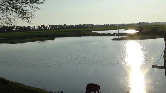
The eye-catching silver appearance of Rangabali is a sight to behold. It could be a potential tourist destination, without any doubt.

In the south of Patuakhali are the Chaulabunia River, Agunmukha River, and Char Biswas. To the north is their location.

Ramnabad Channel and Kalapara Upazila lie to the east. Char Kurri-Mukri of Char Fashion Upazila and the sea are to the south.

Sonar Char Island and Beach

Sonar Char wakes up to the immense beauty of nature in the lap of the sea in the south of Patuakhali. It is in the Bay of Bengal, 50 km southeast of Galachipa in Patuakhali.

It is 40 km east of the tourist center Kuakata, at the mouth of the Buragourang River. Sonar Char is 4 km east-west and 2.5 km north-south.

The total area is 10 square kilometers. The whole island is like an arranged forest. There are various species of trees, including Keora, Sundari, Garan, Hental, and Golpata.

It not only has a variety of trees but also a variety of animals. Deer, fox, buffalo, wild boar, and monkeys live in the forest.

There are four kilometers of beach. Far away from the hustle and bustle of the city, the breathtaking beauty of this beach is still unknown to many.

You can see sunrise and sunset in the same place here, which is rare. The mangrove forests of this region are the sanctuary of honey farmers.

Jahazmara Beach

Jahazmara Beach is about five kilometers from the Upazila headquarters. There are rows of green forests on both sides of the road.
Rangabali Upazila
Md suzan akonCC BY-SA 4.0, via Wikimedia Commons

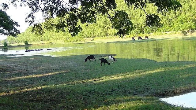
The Jahazmara beach is full of rowing boats and colorful birds. Scurrying red crabs and white oysters are visible on the glittering sand.

Tufania Island

Tufania Island is just south of Jahazmara Beach. Rivers and seas surround this island, which also has green forests. A big zoo surrounds about four kilometers of sea coast.

There is also a long beach of about 1 km. You will see many types of birds and wild animals. These include the white-collared heron, pankauri, and white buck.

You will also see many foxes. You will also meet sincere and hospitable people on the sea and river banks. Rangabali Sadar has cheap catering facilities for the visitors.

Conclusion

It offers a fascinating coastal nature as it is a coastal area of Bangladesh. It is possible to enjoy a good time in this magnificent area of Bangladesh.

Nature gives its blessing to this majestic area of Bangladesh. It has a majestic mangrove forest, scenic rivers, and many beautiful islands.

There is every element available that can attract people. A good time is possible to enjoy with family and friends in this place.

Many people living in this area are members of the fishing community. They use various fishing boats to catch fish from the Bay of Bengal.

Shopping Cart